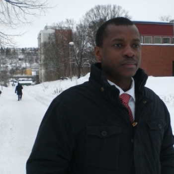
Dr Kursah, Matthew B.

| mkursah@uew.edu.gh |
Kursah, M. B. (2023). Satellite image analysis of thermal comfort for a sustainable urban ecology of Winneba, Ghana. Urban Climate, 52, 101685. DOI: https://doi.org/10.1016/j.uclim.2023.101685
Appiah-Otoo, I., Chen, X., & Kursah, M. B. (2023). Modelling the impact of renewable energy investment on global carbon dioxide emissions. Energy Reports, 10, 3787–3799. DOI: https://doi.org/10.1016/j.egyr.2023.10.043
Kursah, M. B., Biniyam, S. B., Tarawally, M., Segbefia, D., Kunji, S. B., Nyametso, J. K., Agbozo, M. S., Kicheek, C., Owusu-Ansah, E., & Afriyie, A. A. (2023). Analysing landcover and green cover change in Winneba using remote sensing and geospatial techniques. In Y. Danso-Wiredu & J. Weiler Winneba: The Geography, Peoples and Systems. Digibooks Ghana, Tema.
Abotsi, A. K., & Kursah, M. B. (2023). The economic history of Winneba. In Y. Danso-Wiredu & J. Weiler Winneba: The Geography, Peoples and Systems. Digibooks Ghana, Tema.
Dumor, K., Li, Y., Ampaw, E. M., Akakpo, K., & Kursah, M. B. (2022). Dynamic nexus among CO2 emissions, fossil energy usage and Human Development in East Africa: New insight from novel DARDL simulations. Environmental Science and Pollution Research, 29(37), 56265–56280. DOI: https://doi.org/10.1007/s11356-022-19546-8
Appiah-Otoo, I., & Kursah, M. B. (2022). Modelling spatial variations of novel coronavirus disease (COVID-19): Evidence from a global perspective. GeoJournal, 87(4), 3203-3217. DOI: https://doi.org/10.1007/s10708-021-10427-0
Kursah, M. B., Wang, Y., Bayoh, H. D., & Tarawally, M. (2021). A comparative study on the predictive ability of archived and SBAS-InSAR inventories for landslide susceptibility using frequency ratio model. Environmental Earth Sciences, 80(10), 387. DOI: https://doi.org/10.1007/s12665-021-09663-x
Tarawally, M., Xu, W., Kursah, M. B., & Kamara, A. B. (2021). Intra-seasonal variations in urban land surface temperature in two cities in Sierra Leone: The challenge of using a single-date image to represent a whole season. Spatial Information Research, 29(6), 937–947. DOI: https://doi.org/10.1007/s41324-021-00404-7
Tarawally, M., Wenbo, X., Weiming, H., Mushore, T. D., & Kursah, M. B. (2019). Land use/land cover change evaluation using land change modeller: A comparative analysis between two main cities. Remote Sensing Applications: Society and Environment, 16, 100262. DOI: https://doi.org/10.1016/j.rsase.2019.100262
Kursah, M. B., & Wang, Y. (2019). Small Baseline Subset Interferometric SAR technique for spatiotemporal analysis of the Regent landslides. In Global-environment observation and disaster mitigation IEEE International Geoscience and Remote Sensing Society, Yokohama, Japan. DOI: https://doi.org/10.1109/IGARSS.2019.8899096
Kursah, M. B., & Wang, Y. (2019). Landslide inventory using InSAR and ancillary datasets for susceptibility. In Global-environment observation and disaster mitigation IEEE International Geoscience and Remote Sensing Society, Yokohama, Japan. DOI: https://doi.org/10.1109/IGARSS.2019.8898702
Amoah, R. A., & Kursah, M. B. (2019). Geospatial analysis of landfill site selection perspectives using geographic information systems in Bongo District, Ghana. SN Applied Sciences, 1(10), 1237. DOI: https://doi.org/10.1007/s42452-019-1273-y
Kursah, M. B., & Baabereyir, A. (2019). Willingness to pay for sachet water plastic waste management through a deposit-refund system. International Journal of Environment and Waste Management, 23(2), 141–155. DOI: https://doi.org/10.1504/IJEWM.2019.10018022
Kursah, M. B. (2018). Resolving the landfill siting impasse: Modelling technocratic and indigenous perspectives using GIS multicriteria approach. GeoJournal, 83(4), 707-724. DOI: https://doi.org/10.1007/s10708-017-9796-5
Kursah, M. B. (2017). GIS and correlation analysis of geo-environmental variables influencing malaria prevalence. Ghana Journal of Geography, 9(3), 112–131. https://www.ajol.info/index.php/gjg/article/vie...
